Antique Coloured Map Of The Fens C. 1646 by Joan Blaeu
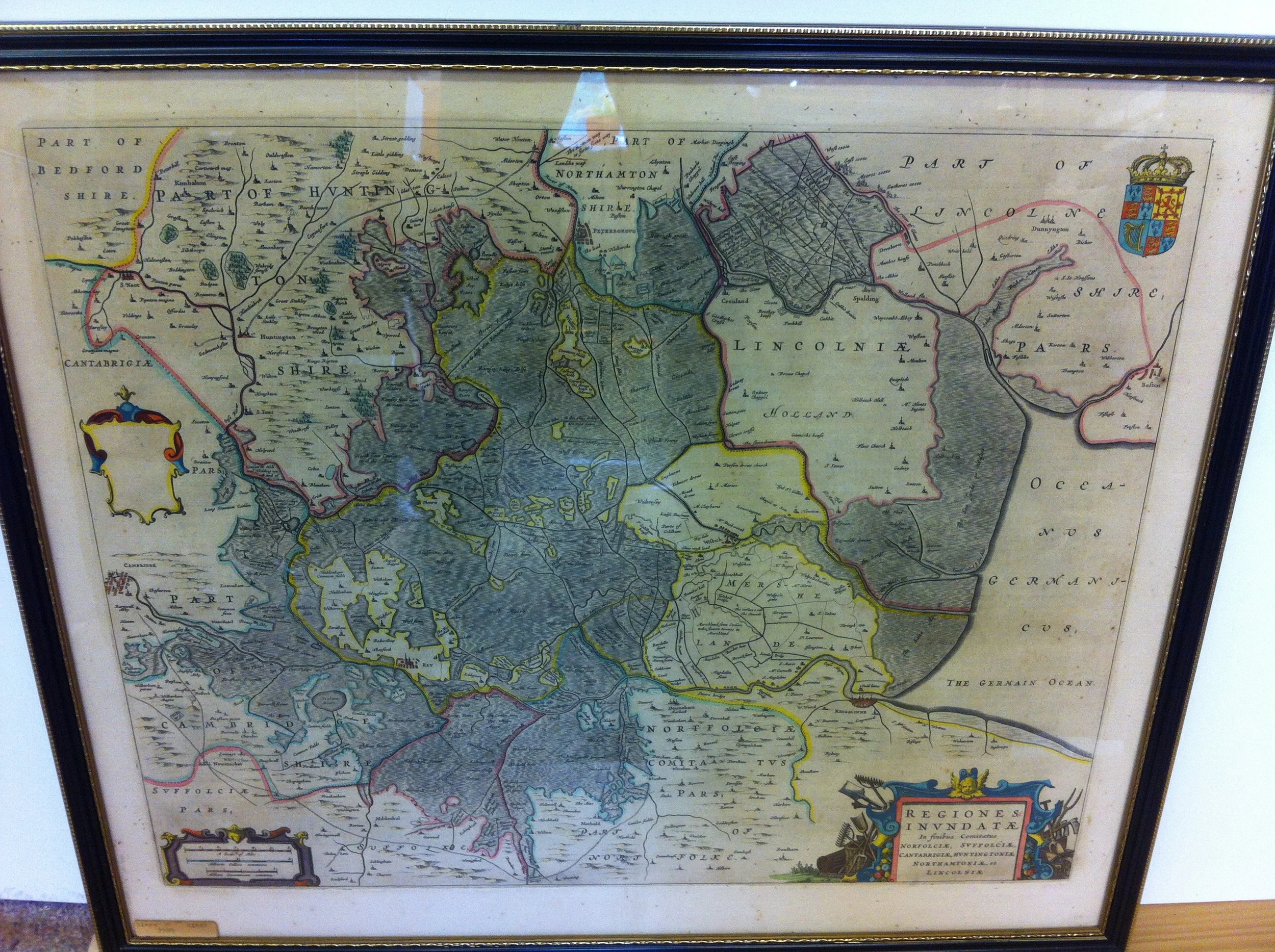
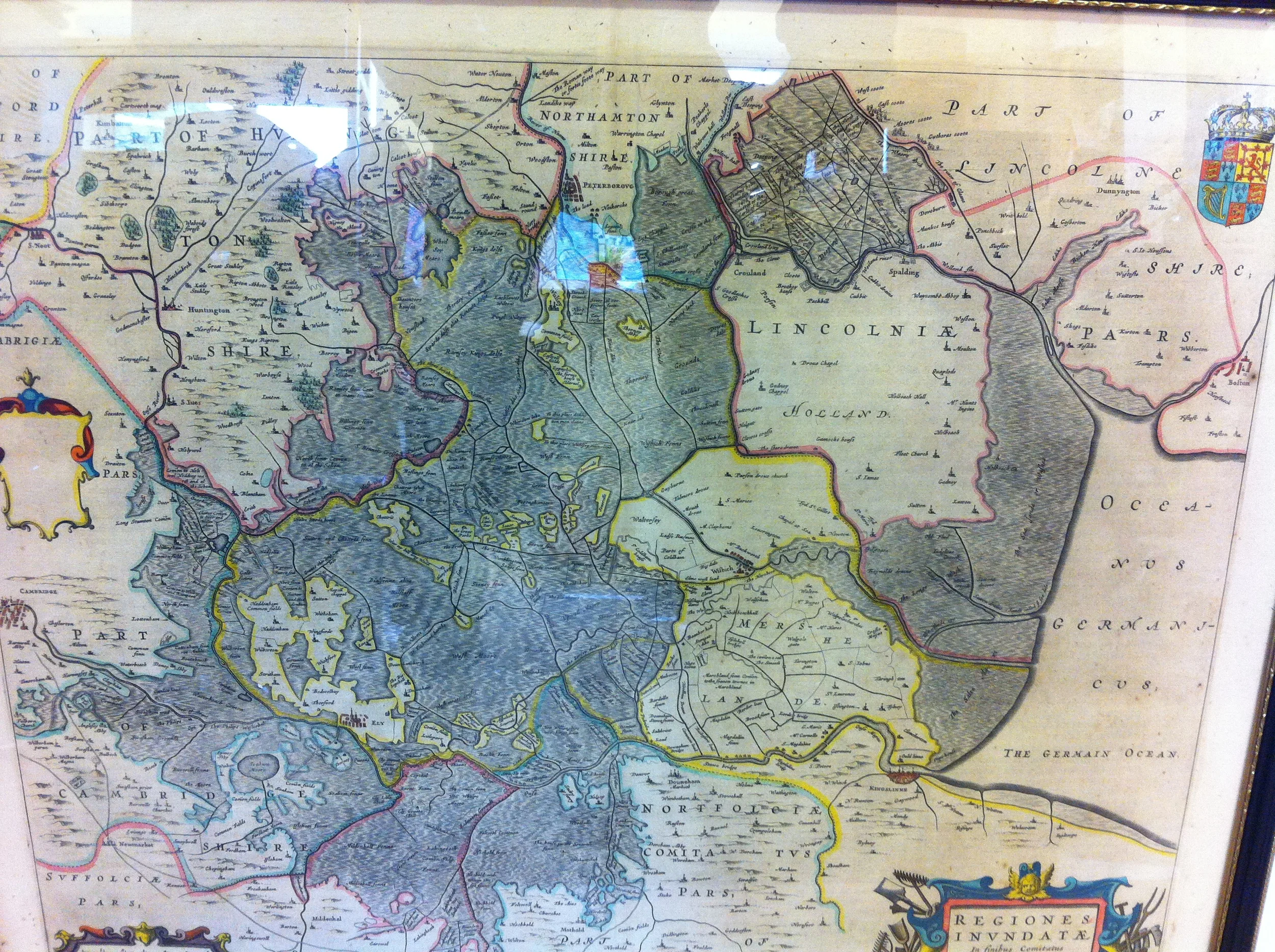
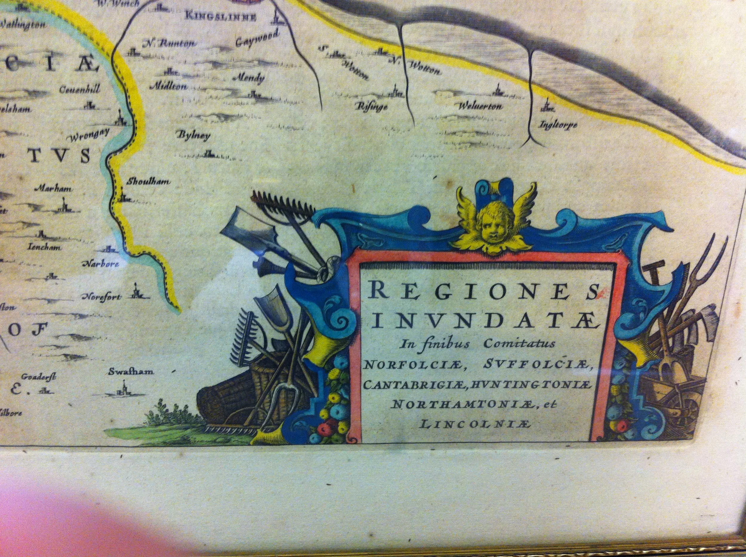
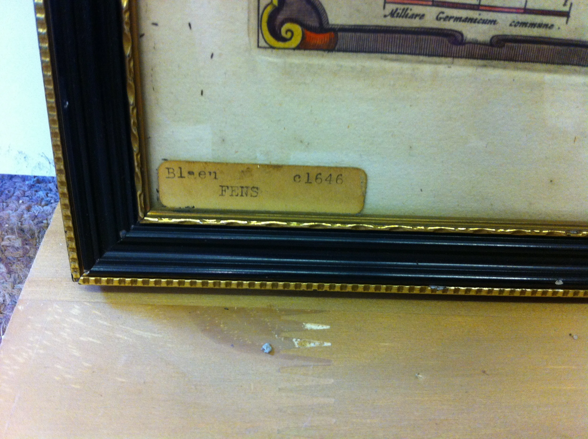
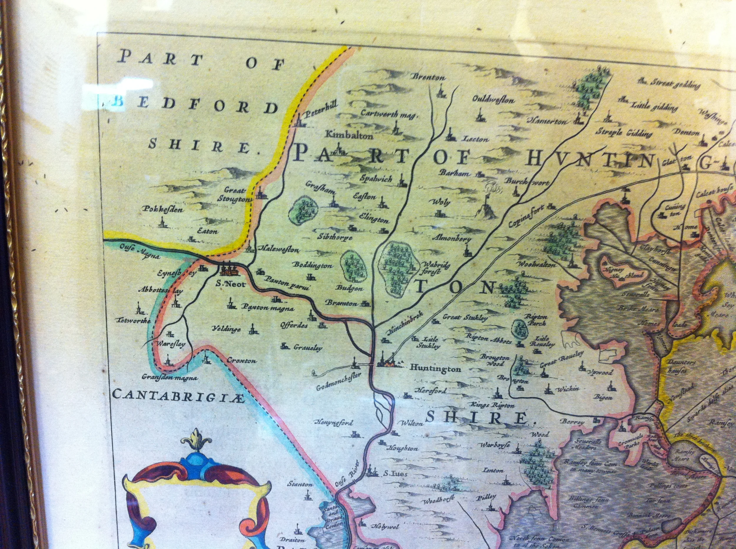
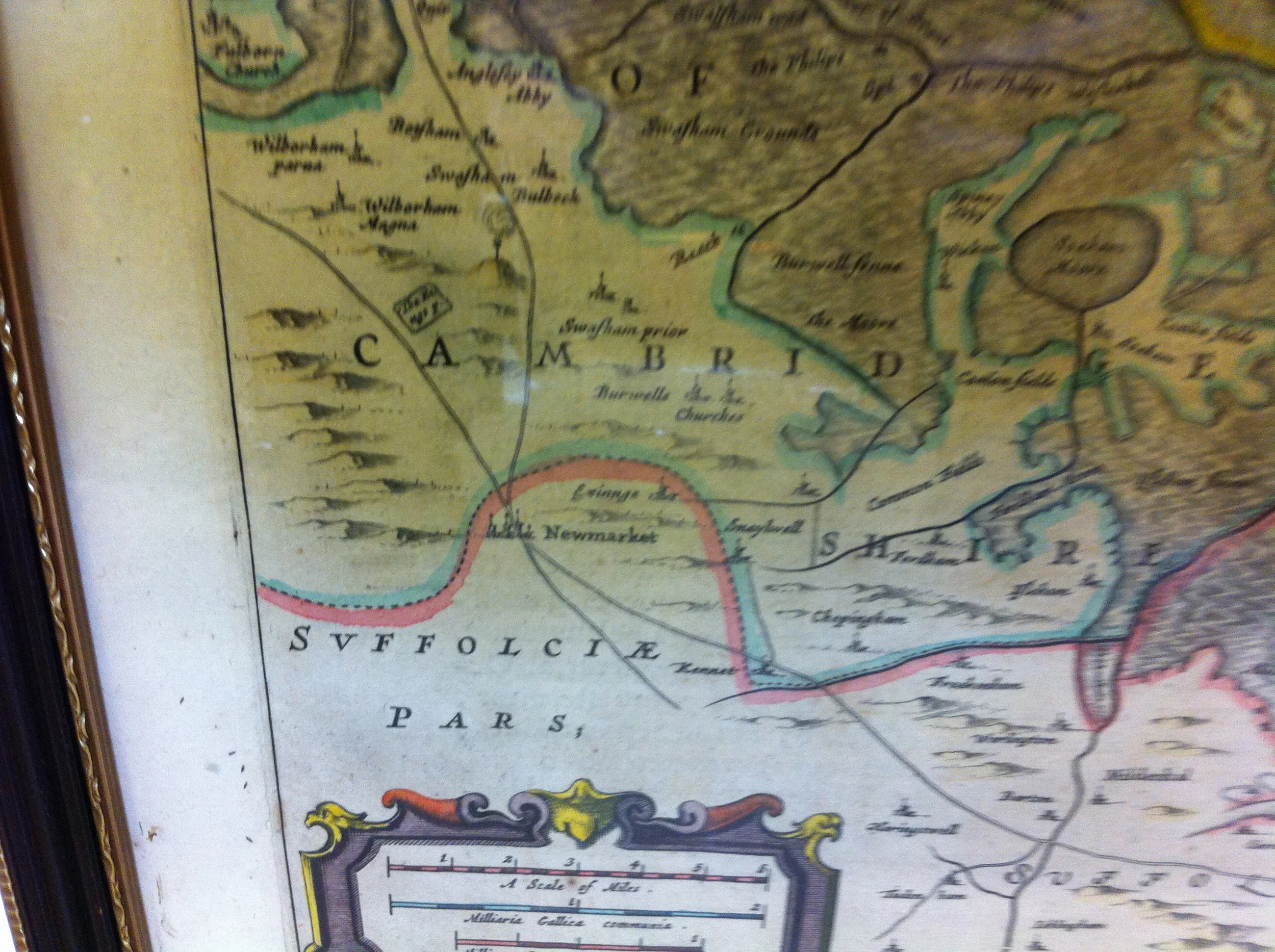
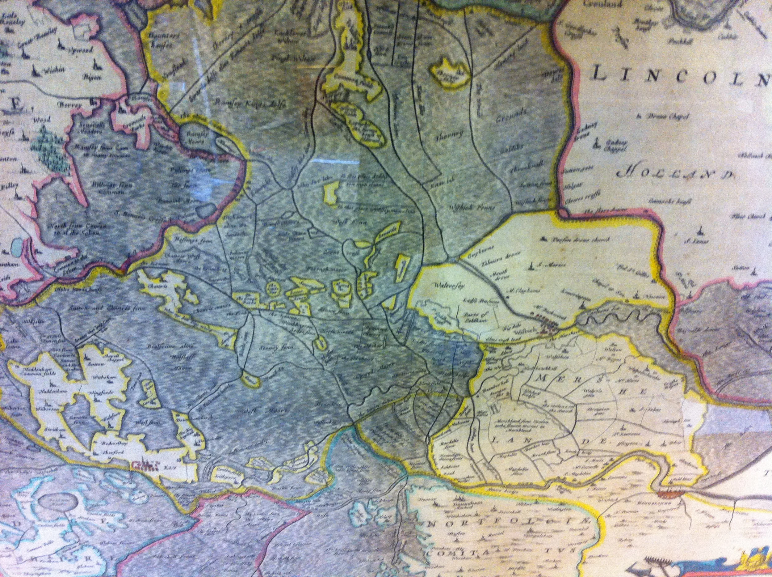

Antique Coloured Map Of The Fens C. 1646 by Joan Blaeu
£195.00
Regions Including Norfolk, Suffolk, Cambridgeshire, Huntingdonshire, Northamptonshire & Lincolnshire.
Map measures approx. 54cm wide x 43.5cm high
In a good condition in a black and gilt frame. Some small bugs between glass and edges of map.
Free UK Postage
Any questions please call or email us